Friday, 24 August 2012

Using ArcGIS Online to track our bears


For those of you that attended this year’s Esri International User  Conference, you may already be familiar with this character!
For those of you that didn’t get to the event …let me explain! 

This is Socium Bear and he, along with all his brothers and sisters, joined us on the 1Spatial stand to help promote the new business applications that will be launched on the 1Spatial Cloud Platform in the coming months. These will integrate with and extend the capabilities of Esri’s ArcGIS Online, offering users apps for data validation, correction, integration, inference and generalisation.


Lucky event attendees, who adopted one of our small bears, were encouraged to join in our fun campaign and download the free Esri ArcGIS app so that they could add photos of their bear to our map and also put a pin in their home location so that we could see where in the world the bears travelled to. This created a lot of fun on the stand for attendees to the event but we are also really delighted to see that the world map is already starting to see an invasion of the bears being tagged in their new home locations.
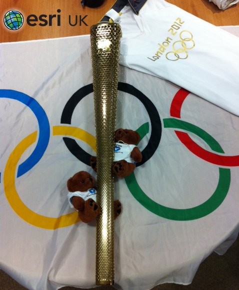
So far bears have touched down in Canada, Australia, Poland, Germany, Italy, Spain and the UK. There is even a photo posted by Esri themselves of two of the bears with the Olympic Torch near London in the UK!  There are also lots of photos across the United States and a number of them were posted in San Diego during the event. One bear even took a trip up to Hollywood after the conference finished as there are photos of him hanging out with the stars!If you attended the event and have one of the bears, you can still get involved and post your photos or home location. Full instructions are on the website along with the map that shows where in the world the bears have already appeared http://www.socium.co.uk/sociumbear/


Monday, 28 May 2012

Taking a walk on the wild side

By John Hartshorn
We all know walking is good for you, so over the course of this last weekend, a joint 1Spatial/Linknode team took on the challenge of walking up to 100km in Oxfam’s Trailtrekker 2012 endurance trekking challenge in the Yorkshire Dales, and raising around £5k for Oxfam.

The weather was just perfect – warm, dry, and with a refreshing (although dessicating!) wind.  And scenery...well, one person is quoted in the Yorkshire Post’s coverage of the event describing it as very “Tolkein” like.  As a local, I would describe it as rolling upland terrain! 

A team of four (John Hartshorn, Dave Eagle, Crispin Hoult, Nic Snape), calling ourselves Abi & The Pacemakers, we started at 6am on Saturday in Skipton with the aim of getting as far round the challenging 100km as possible.  840 people set off, and it didn’t take long for us all to disperse into our little foursomes.  The banter as teams passed each other or walked a while together was just great, adding to overall spirit of the whole event.

The course was certainly rugged and demanding in parts – up Malham Cove, over Fountains Fell, across the shoulder of Pen-y-Ghent (one of North Yorkshire’s “Three Peaks”), and after a refreshing meal put on by our outstanding support crew (Tim Downs, Tung Nghiem, Chris Tagg) the long, relentless yomp to Cam Farm at the top of Langstrothdale.  That was half way and had taken over 13 hours!  By this time, blisters were starting to emerge, and iPod’s were being switched on – nothing like being able to disappear into music to take the mind off the slog.  It was then down into Wharfedale and a meal stop and leg massage at Buckden before the night trek along the river Wharfe.  By the time we then got up high on the Limestone pavement above Conistone, the sun was rising for another beautiful day and stunning vistas. 

At Coniston, two of the team decided that 80km was ample (one of which had only ever set out to do the 40km Bronze challenge, but was cajoled into going further by the rest of us!), and so set the other two on their merry way with the remnants of another team for the last 20km.  They still faced a 6 hour hike back down to Skipton and with some more challenging ascents up and over Malham Moor and then, after a water stop (and the smiling, encouraging faces of our support crew!) at Hetton, one last climb up the seemingly never ending and unfeasibly steep forest track around Sharp Haw before the final few km down into Skipton.

To be met by the whole crew and some family members at the end was just astounding – a real hero’s welcome back. 

And today?  A few interesting blisters, but otherwise fine!

What an experience.  Again.

Keep an eye on the 1Spatial TrailTrekker page for photos of the team throughout the challenge. Don’t forget,  you can still reward the team for their mammoth efforts by donating a little something here


Wednesday, 21 December 2011

Eye on the Earth Summit

Posted: Mike Sanderson

I was privileged to be able to attend the Eye on Earth summit convened under the Patronage of His Highness Sheikh Khalifa Bin Zayed Al Nahyan, President of the United Arab Emirates. AGEDI and UNEP gathered a panoply of world leaders in their fields for the plenary sessions. Jane Goodall talked enthusiastically about the chimps in equatorial Africa, polar explorer Rob Swan was passionate in his defence of Antarctica, Sylvia Earle (formerly Chief Scientist at NOAA) introduced us to blue carbon, Rebecca Moore from Google outreach talked about the Google Earth Engine. This was a call to arms event for sustainability.

The highlight was the presentation from Hernando de Soto of the Institute for Liberty and Democracy, Peru. He talked about the Tunisian street trader, Mohamed Bouazizi who set himself on fire just over a year ago. Hernando described the feeling of hopelessness that this individual felt as he realised that to trade legitimately he had to seek permits from 73 government agencies.  Development is key to human progress and cannot be avoided, so the role of government is to allow development whilst maintaining a balance with the environment and other individuals. The initiatives announced at the conference (see: http://www.iisd.ca/ymb/uncsd/eoes/) were purposeful but for us to return in 2013 and measure their success they need to pass the Bouazizi test (they need to produce a simpler form of interaction between the individual and government).

And for 1Spatial, the summit declaration contained the following words:  ‘we need to develop effective mechanisms for collecting, managing and disseminating necessary environmental information, with the responsibility for quality assurance resting with those who collect or originate the data.’